All posts by Bobaschriftlich

CDT’19 Trailmile 792 – Chama

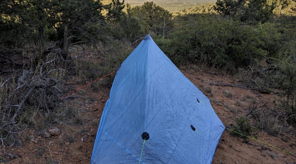
The section from Cuba to Chama over Ghost Ranch was a mixture of scenery and the hardest 150 miles yet on my CDT hike. I was not willing to send resupply to Ghost Ranch at mile 54 of the 150 as it would have cost a lot of money – so I carried 5 days of food and planned to eat a meal at Ghost Ranch and do a little snack resupply at their store.

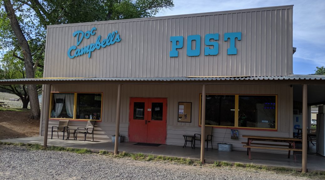
I arrived there on day 2 of that section at 5:30 so the store was closed, but I was able to buy and eat dinner which was great. But that also meant that my food was limited so I aimed to finish the section on Saturday in time to get my package from the post office at Chama which closes at noon.

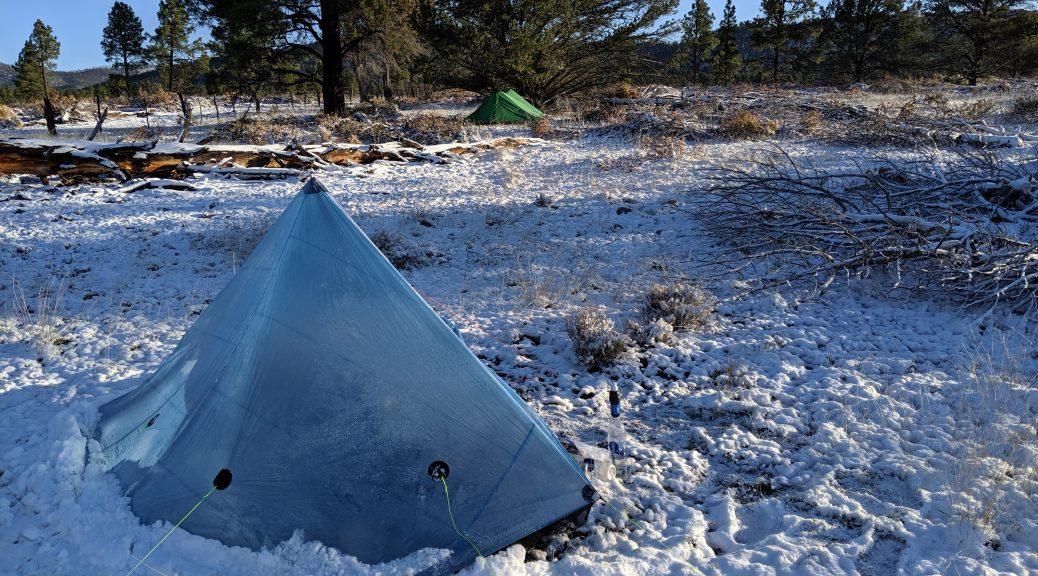
This proofed to be quite a challenge as the last 70 miles or so where quite high up above 10000 ft and were either covered in snow or were turned into mud fields and swamps by the snow melt. It was physically challenging, especially postholing late in the day and my shoes were pretty much constantly wet.

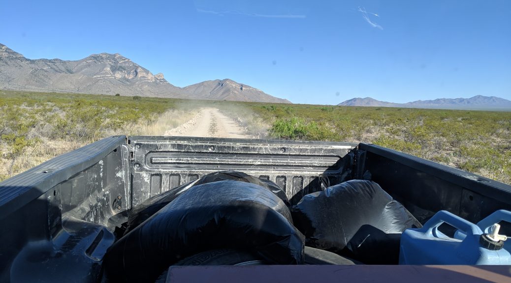
But in the end I made it to the highway 17 in Colorado by 10 am today which has very little traffic and got the lucky hitch as a section hiker named popsicle came by and picked me up within 45 minutes of standing by the road.

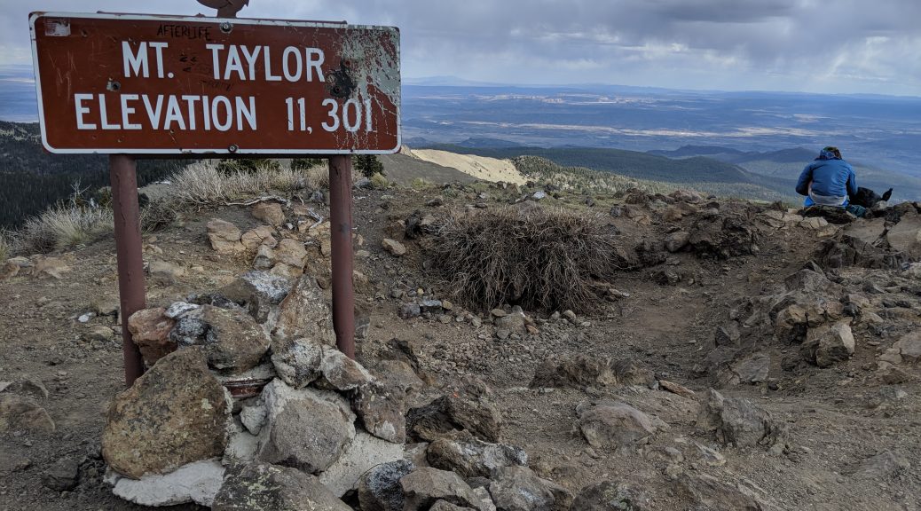
As the highway 17 is about 3 miles into Colorado, it means that I completely finished the New Mexico section and after hiking through that much snow, my decision to flip to Montana makes even more sense to me now.

I will take the bus on Monday to Espangol and then to Santa Fe and then I need to organize my travels to Chief Mountain in Montana to start my southbound hike back to the New Mexican border. I also need to prepare for grizzly country and need a permit for the Glacier National Park – so there is plenty to do!

CDT’19 Trailmile 642 – Cuba

It has been a fantastic section from Grants to Cuba with very few roadwalks. We opted to hike the alternate over the peak of Mt. Taylor (11301 ft) which was quite a challenge with a but if snow on the north side of the way down but rewarded us with awesome views of northern New Mexico.

The following day was overcast and a little rain came down with thunderstorms in the distance and mainly forest roads to hike, so me and Pretzel decided to make it a big mile day and I ended up doing around 37 miles. That made the next day a little harder, as the terrain got more unwieldy to hike but very pretty to look at.

All the way from that point on was real trail going through canyons and on top of plateaus with plenty of views. The last two days into Cuba were also the first real hot days since the start of the hike so I was using my reflective umbrella and lots of water to battle the heat.

By freak chance I actually met Legion, a hiker I hiked on the PCT in 2012 and also had met on my AT section hike in 2013 as well as me AT thruhike I’m 2014. He was hitching out to see a concert but O probably will meet him again once I start going southbound. The trail world can be quite small sometimes.

Next stop will be Chama, NM from where I plan to flip up to the border of Canada and start Hiking back to Chama to complete the Trail going southbound.

CDT’19 Trailmile 536 – Grants

It has been a a fun filled rest day at Pie Town in the Toaster House and a short 15 mile hike to the TLC Ranch. To contrast that, most of the miles towards Grants have been hard dirt road or paved road walks only broken up by little canyon sections that I choose to do.

We got to Grants last night after doing a 34 and a 26 Mile road walk and I was pretty beat when I got here. I already did the town chores although I need to go to the Post office which is a 2.6 mile walk from the Motel I am staying. I will likely do that on my walk out of town.

The next section to Cuba will be more actual trail and will have no option to stay at a ranch like TLC ranch, where we got warm dinner and breakfast so I will have to carry more food out.

I stayed at the Sure Stay with Six Meals and Pretzel and am looking forward towards a section with a little less distractions.

CDT’19 Trailmile 410 – Davila Ranch

It has been a couple of interesting days walking the remaining Gila River alternate path which lead to more river crossings, but I also decided to take the high route to avoid the middle fork section of the Gila which would have meant at least 90 additional crossings.

I went to see the Gila Cave Dwellings National Monument which was very interesting to visit and finally was done with the river section when I was hit with a unanticipated Snow Storm. I met Herro that was keeping me company during the storm and we were able to hide inside a van from a guy that just happened to pass through. The storm cleared up and I continued with Herro and Micah when it started to snow again so we opted to camp out in the snow for that night.

After that Snow Storm I hiked two long days mainly solo but then grouped up with Pretzel to hike my first day over 30 miles into the Davila Ranch. Next stop will be Pie Town in 14 Miles from here where I do not intend to stay and Grants about 90 Miles from here where the next Motel is waiting for me.

CDT’19 Mile 206 – Doc Campbell

After enjoying a rest day at Silver City I headed out on day 9 of my hike and chose to head to the Gila River alternate which most CDT hikers do due to better resupply options as well as it being very beautiful. The day had the next mountain in it’s way so it took me a while to get up it and partly back down to set up camp.

Last night’s camp was about 20 miles to Doc Campbell Post which is a little store right on the side of the trail after coming out of the Gila River Trail. That said trail was very pretty, but also quite demanding as it goes along side a windy river within a canyon and this causes the trail (if you are able to find it) to be on either side of the river. I did not count, but some hikers at Doc Campbell confirmed that it crossed over at least 20 times. This meant that I just kept the shoes on and carried on – now said shoes are drying – hopefully – in the evening sun. The owners of the store where still there past the official hours so I got my resupply package and paid for a shower in the morning – that I am looking forward to.

Next Resupply Stop is Pie Town in about 120 Miles, which I am targeting to reach in about 5 days.

CDT’19 Mile 161 – Silver City

Before leaving Lordsburg I needed to go to the Post office to send food to a resupply point that has no groceries and also to forward my snow gear which I won’t need before Colorado.

The first part getting out of Lordsburg was really dry and hot going through treeless desert and the mountains were welcome at the end of the first day. But due to my trail legs still developing I split up with Pretzel and did the first solo night, which was very nice and relaxing.

The second day after Lordsburg proved to be pretty hard on my legs as the trail went up to Jack’s Peak at over 8000ft. I walked as far as I could after climbing up and down that mountain and was left with 27 miles to Silver City.

Today was enjoyable during a canyon walk with very pretty views, but as I had decided to make it into town the second part was a 13 mile highway walk towards the city which was made a little more enjoyable as I met Raff a hiker from Australia with which I could share some stories. I decided to take a hotel room and have already done most of the chores as well had dinner. Tomorrow I will need to buy some more food that I need to forward to the Toaster House in Pie Town. I am looking forward to that place just by the names alone.

CDT’19 Mile 85 – Lordsburg

The first 4 days of hiking are done! I arrived at Lordsburg today with my fellow thru-hiker Pretzel whom I met on the shuttle to the trailhead. So we are back where we started as the CDTC shuttle leaves from this trailtown. The town itself ist located right on trail, which makes it very easy to get to as no hitchhiking is required.

The first few days were days of adopting to hiking big miles daily, New Mexico weather and the CDT trail navigation challenges. As the trail is going through the desert, with a lot of washouts and flat sections with lots of scrubs and thorns it is pretty easy to loose the trail here and there.

We had incredible luck with the weather, as we got a lot of clouds and only a few drops of rain which made the journey a lot easier than in the full sun.

The next stop will be Silver City, NM and I will be leaving tomorrow morning in that direction after spending a night at the hotel.

Travel to the CDT Southern Terminus

The journey to the CDT started on May the 7th in Hamburg, Germany where I boarded the plane to Cincinnati. The last leg of the journey was a little delayed though, so I ended up at my Hotel at the airport at 2am in the morning while needing to catch my next flight to Tucson, AZ at 7am. The result was a very short stay but at least I got a refreshing shower after being on the road for more than 30h already.

At Tucson I went to Walmart to buy the food for my first 4 days of the hike and then boarded the Greyhound Bus to Lordsburg,NM on May the 8th. By happenstance the Bus was delayed as well so the wait at the station was quite long and I was very glad to arrive at Lordsburg around 7pm to spend the night in the Hotel.

On the next morning I boarded the shuttle to the Crazy Cook Southern Terminus of the CDT at 6:30am – together with 2 other hikers with the trail names of Pretzel and Top Gun. The adventure is about to start!

Planing to Hike the CDT in 2019

For quite a while I have been dreaming to hike the continental divide trail – or in short: CDT. This trail is one of the ‘big three’ long distance hiking trail of the continental U.S.A going from border to border through 5 states: New Mexico, Colorado, Wyoming, Idaho and Montana.

While it is less popular than the AT and even the PCT by quite a margin it certainly does not lack in beauty or appeal. Being less popular can be mainly distributed to being the most challenging trail of the three. This challenge comes from several factors, starting with it’s length: Approximately 3100 miles long. Why an approximate you might ask? Well the trail is different to the AT or PCT in terms of the official route. As not all of the trail is along the terrain and land that the CDT organizations want it to be, larger sections are currently still road walks or are not yet along the desired place. This means that there is no one specific route to hike the CDT but many ways to hike a continuous route from new Mexico to Montana. This makes the trail pretty unique and also enables most hikers to choose their favorite parts and provide the option to avoid high sections in deep snow or enable them to hike around areas closed due to fire, while still being a ‘purist’. But it also means that navigation of this trail is more advanced than the PCT (AT being the easiest to navigate) and one should plan to find yourself of trail once in a while. Not only are there way less markers than on the PCT, but also less people hike the trail in total numbers and more sections are less well maintained.

Another challenging aspect of the CDT is the fact that longer sections are at high elevation, especially in Colorado where large sections of the trail elevation is above 10000 ft. This causes less predictable weather patterns and more afternoon thunderstorms where you don’t want to be on top of an exposed ridge if you can avoid it.

Further challenges can be distance between water sources and water quality – especially in New Mexico, large sections that are Grizzly country and require precaution, and long distances between resupply points.

These are some of the reasons for most hikers to choose to do the CDT after already having some thru-hiking experience.

I am personally drawn to hike this trail in part due to all these challenges and it’s unique landscape and look forward to start my hike in early may of 2019.


Meile 2185 – Mt. Katahdin und Millinocket

Es ist geschafft! Am morgen des 27.08 habe ich zusammen mit UPS und Aquaman die Spitze von Mt. Katadhin und somit das nördliche Ende des Appalachian Trails erreicht. Somit habe ich das Ziel den Trail in dem drei Monate Rahmen zu durchwandern erreicht.

Der letzte Abschnitt von Monson bis zu Katahdin war die sogenannte 100 Meilen Wildniss, die anspruchsvolle 30 Meilen zu Beginn bot aber dann recht einfach zu wandern war. Ich hatte die 100 Meilen am Vormittag des 4. Tages geschafft und erreichte Abol Bridge – ein Campingplatz mit Laden. Zum Thruhiker Glueck verkauft dieser nicht nur Snacks sondern auch Bier, und es hat ein Restaurant in dem man warmes Essen bestellen konnte. Gestaerkt konnte ich dann am Nachmittag des 26. August die letzten 10 Meilen zum finalen Shelter angehen.

Die 100 Meilen Wildniss war einer der Highlights des AT, da es trotz der flachen Abschnitte schoene Aussichten bot, eine davon die erste Sicht auf Khatadin von Whitecap Mt.  Zudem habe ich in keinem anderen Abschnitt derart oft in schoenen klaren Seen schwimmen koennen.

Das Ende des Appalachian Trails haelt wieder zwei polare Emotionen: Die Freude den Trail geschafft zu haben und nun endlich ein paar Tage faul sein zu duerfen und zum anderen die traurige Realisation, dass die Reise nun zu Ende ist und ich die Faeden der Zivilisation wieder aufnehmen darf bzw. muss.

Heute habe ich einen netten Tag im Hotel genossen, bevor es morgen zurück in Richtung Montreal und Arbeit geht.